Two hours
Two hours for exteriors: Plaza Mayor, Arco de la Estrella, Santa María, Golfines, San Jorge and San Mateo. Add Veletas exterior if time allows; the Baluarte needs descent and return time.

WHAT TO SEE AND HOW TO PLAN
Cáceres brings together trading squares, palaces and defences revealing centuries of urban change. Eight central stops involve slopes and stone paving. Veletas is an exterior stop: museum works require checking available spaces, and cistern access is not guaranteed. Coordinates are approximate; accessibility has not been audited.
Durations are indicative: queues and all indoor visits are not included.
Two hours for exteriors: Plaza Mayor, Arco de la Estrella, Santa María, Golfines, San Jorge and San Mateo. Add Veletas exterior if time allows; the Baluarte needs descent and return time.
Explore all eight stops with breaks and lunch. Choose the co-cathedral, palace or a municipal centre with admission confirmed rather than every interior. Veletas and its cistern are not assumed open.
Day one for squares, palaces and one interior visit. Day two for San Mateo, the Baluarte and Jewish quarter, plus museum collections only in the building and spaces confirmed open by the museum.
Look for coats of arms, towers and gateway shapes, alternating short walks with square breaks. Choose one admission and check stairs: bell towers, bastions and paving are not automatically accessible.
Prioritise co-cathedral or palace visits with access confirmed and central lunch. Do not depend on Veletas cistern or bell towers. Limit slopes and wet stone; confirm available rooms with the museum.
OpenStreetMap loads on request. Markers are indicative, not audited entrances. Use links for street directions.
Audio uses your device voice and depends on your browser. The full text is always available to read.
1 / 8 · CÁCERES
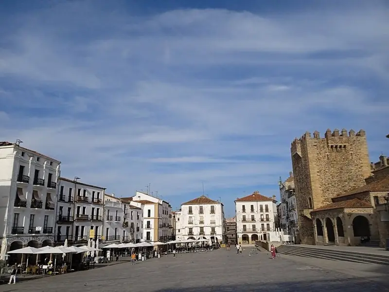
Plaza Mayor helps explain how Cáceres expanded beyond its walls. Markets, crafts and public gatherings concentrated here, opposite an enclosed town dominated by noble and religious buildings. The western arcades, consolidated in the sixteenth century, supported commercial activity and still organise the relationship between façades and pedestrian space. Look towards Bujaco tower and the Arco de la Estrella: defence and urban circulation appear together in one view. Before entering, compare the square’s breadth with the streets you will encounter afterwards. Not everything that looks medieval belongs to the same period; successive alterations adapted this space to changing needs. It makes a useful beginning and a convenient place to return to when the walk is finished, without needing to rush straight through.
Explanation source ↗2 / 8 · CÁCERES
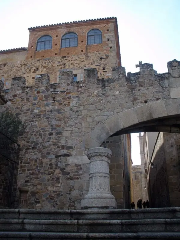
The Arco de la Estrella links Plaza Mayor with the Santa María area, but it is not a medieval gateway preserved unchanged. Manuel de Larra Churriguera built it in the eighteenth century over an earlier fifteenth-century entrance. Its low, angled shape answered a practical need: allowing carriages to pass more easily. Notice that the opening does not operate as a rigidly perpendicular passage through the walls. That slight turn tells a story of adaptation, when comfortable access became more important than military function. Walk through slowly, leaving room for other people, and look back towards the square. Within a few steps, urban scale changes from the large commercial space to the streets and representative squares of the monumental enclosure.
Explanation source ↗3 / 8 · CÁCERES
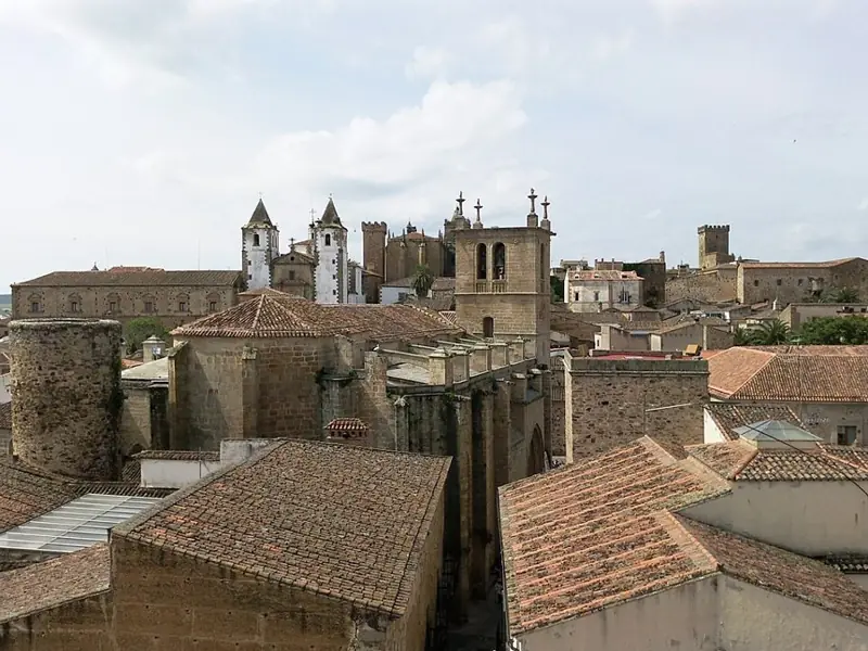
Santa María reveals a religious history extending beyond a single façade. The church acquired co-cathedral status in 1957 and retains earlier features, including Gothic doorways. Its stone mass converses with the palaces surrounding the square: different kinds of authority and representation met here. Before entering, observe the differences between entrances, buttresses and tower. If you visit inside, allow time for the Renaissance altarpiece and the arrangement of space rather than racing to recognise names. The tower provides another reading of the urban ensemble, but climbing requires checking admission, opening and stairs; standing in the square does not automatically include access. Respect worship and distinguish a cultural visit from religious celebrations. A slower look makes the successive architectural layers much easier to understand.
Explanation source ↗4 / 8 · CÁCERES
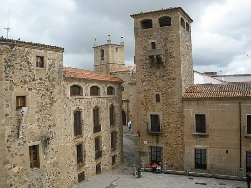
San Jorge introduces a Baroque presence into a landscape often described only as medieval and Renaissance. San Francisco Javier church, built for the Jesuits in the eighteenth century, was completed in 1752. Its twin towers and composed façade create a vertical setting revealed as you climb from Santa María. Pause to notice how steps, changing levels and buildings direct your gaze: this is not a flat square. The saint’s statue recalls the patron of Cáceres, but the square’s name should not be confused with the church’s dedication. If you want views from the bell towers, check current admission and access conditions. The exterior stop is enough to recognise the contrast between periods before continuing towards the higher part of the old town.
Explanation source ↗5 / 8 · CÁCERES
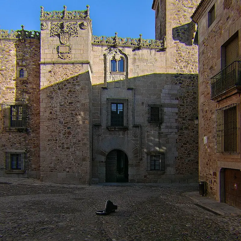
Golfines de Abajo Palace shows how a residence could express lineage, wealth and closeness to power. Its façade combines defensive inheritance with a more ornamental presentation, visible in heraldry and in the differences between its towers. Look for the arms of the Golfín and Coello families and compare the appearance of the building’s different parts. This is neither a house constructed in a single campaign nor an isolated fortress: the palace belongs to a network of noble residences within the city. Its association with the Catholic Monarchs, who stayed here, enhanced its political meaning. Interior visits have separate arrangements; from the street you can already read the owners’ language of representation. Do not confuse this building with Golfines de Arriba Palace elsewhere in the old town.
Explanation source ↗6 / 8 · CÁCERES
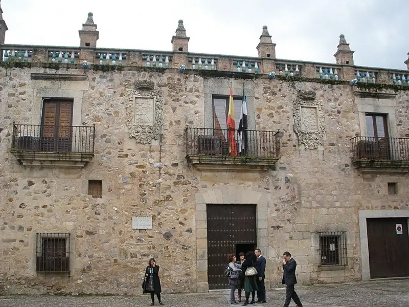
Las Veletas brings together a noble residence and a much older history of water. The palace occupies the site of a former citadel and preserves beneath its structure a Hispano-Muslim cistern, with horseshoe arches and aisles organising the reservoir. This layering explains how a building can appear to belong to one period while containing another below ground. Its relationship with Cáceres Museum adds archaeological, artistic and ethnographic collections to the place’s interpretation. However, works announced by the regional government have changed exhibition arrangements and prompted transfers to Casa de los Caballos. This is planned as an exterior stop: check directly which museum building opens and whether the cistern accepts visitors. Reopening has not been verified, so it should not be assumed when planning your day.
Explanation source ↗7 / 8 · CÁCERES
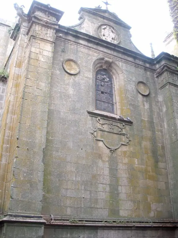
San Mateo stands in one of the highest parts of the old town, on a site associated with the earlier mosque. The visible building largely reflects sixteenth-century work, with subsequent additions explaining its mixture of Gothic, Renaissance and Baroque features. On the doorway, look for medallions of Saint Peter and Saint Paul, then compare their decoration with the restraint of the walls. The exterior mass allows you to recognise the large nave and its supports without entering. If the church is open to visitors, observe how side chapels change the plan and the experience of space. This square concludes a gradual ascent through the town, making it a useful place to rest before descending. Respect worship and follow the access arrangements indicated on site.
Explanation source ↗8 / 8 · CÁCERES
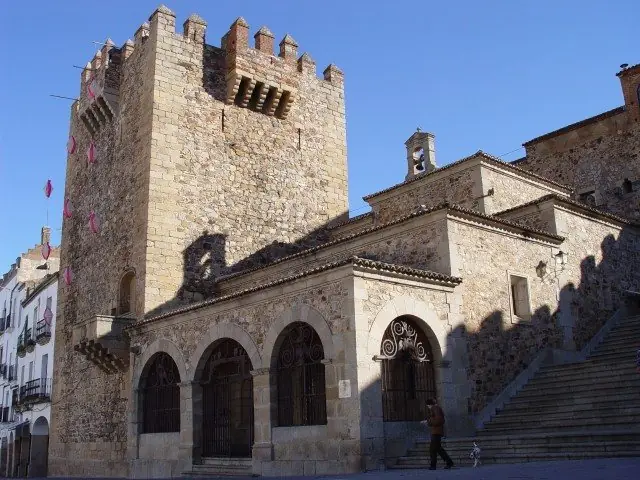
Baluarte de los Pozos invites you to consider Cáceres’ defences through their relationship with water supplies. Towers and walls protected more than homes and symbols of authority: securing water was essential to withstand a siege. This sector of Almohad origin belongs to the eastern landscape of the enclosure and connects military history with the sloping ground. Approach using authorised paths and notice how the defensive structures project in relation to the main wall. The interpretation centre and elevated areas have their own admission arrangements, subject to opening and conservation conditions. This is not a continuous, freely accessible walk around every bastion. Afterwards you can continue through the surrounding Jewish quarter and plan your return towards the centre without assuming all paths or viewpoints are open.
Explanation source ↗Calle Condes, 3, 10003 Cáceres
Restaurant near San Mateo with its own food and wine list. Check availability and book directly; distinct from the Atrio restaurant.
Official website ↗ · Walking directions ↗Calle Ancha, 6, 10003 Cáceres
Traditional Extremaduran cooking in the monumental centre. Its own website provides menu and booking information, including specialities such as zorongollo and migas; confirm the current offer.
Official website ↗ · Walking directions ↗Calle Juan Solano Pedrero, 15, 10005 Cáceres
Contemporary cooking using seasonal produce. Located in Nuevo Cáceres outside the monumental circuit: plan a separate journey and consider booking.
Official website ↗ · Walking directions ↗Editorial selection based on the venues’ own websites, not a personal dining review or sponsorship. Check opening, menus, allergens and prices before visiting.
Check final prices, conditions, tour language and availability on Civitatis. Optional paid activities; affiliate links may earn a commission. Check the interiors included on your chosen date: museum refurbishment may affect the itinerary.
See activities in Cáceres ↗Check Renfe for trains to Cáceres and plan the station-centre connection. Vectalia publishes urban routes and maps; the coach station is not an immediate arrival inside the monumental enclosure either. The historic centre involves walking, slopes and uneven stone. Bell towers and bastions require checking stairs and separate admission. Coordinates are approximate and accessibility has not been audited.
Emergencies: 112. For non-urgent medical assistance, consult local services.