Two hours
Two hours: Puerta de Purchena, cisterns if open and cathedral exterior. Explain the shelters from outside without assuming admission. Give the Alcazaba another time block.

WHAT TO SEE AND HOW TO PLAN
Almería combines an Islamic fortress, defensive cathedral, medieval water infrastructure and industrial heritage. The central core links Purchena, cisterns and cathedral; the Alcazaba, museum and waterfront need separate blocks. Works were announced for the shelters in October 2026 and interior opening is not confirmed. Cabo de Gata is a separate outing beyond the city walk.
Durations are indicative: queues and all indoor visits are not included.
Two hours: Puerta de Purchena, cisterns if open and cathedral exterior. Explain the shelters from outside without assuming admission. Give the Alcazaba another time block.
One day: Alcazaba in the morning after checking its calendar, then old town, cathedral and lunch. Choose museum or Cable Inglés in the afternoon, checking access through Parque de la Estación. Shelters are not an available interior.
Two days: Alcazaba and old town on day one. Museum, Cable Inglés and part of the Zapillo promenade on day two, adapting transfers to energy and heat. Cabo de Gata and Los Millares need separate trips and transport.
Families: shorten the centre to Purchena and cathedral exterior, choosing museum or beach as another block. The Alcazaba adds an ascent and sun exposure. Do not promise shelter access or make eight stops compulsory.
Rain: prioritise the museum and cathedral with confirmed opening, plus a central meal. Shelters are not guaranteed because of works. Omit exposed Alcazaba areas, Cable platform and beach during weather warnings or strong winds.
OpenStreetMap loads on request. Markers are indicative, not audited entrances. Use links for street directions.
Audio uses your device voice and depends on your browser. The full text is always available to read.
1 / 8 · ALMERÍA
Separate outing beyond the central walk
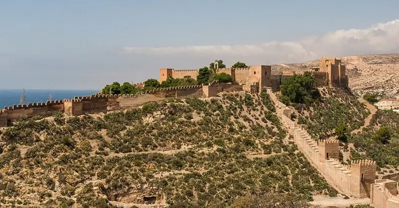
The Alcazaba explains why Almería’s history cannot be separated from its port. Abd al-Rahman III ordered the fortress built in the tenth century when the settlement received city status. This elevated position protected a maritime outlet that became important within al-Andalus. Three enclosures form the complex: two associated with its Islamic layout and a third Christian one, showing how continued occupation transformed the site over centuries. Notice the changing relationship between walls, terrain and city as you move through it. Defence was not the only activity: reconstructed houses introduce everyday life and archaeological materials. The ascent and visit need a dedicated block. The Andalusian government directory lists the site as open, but check its current calendar before planning your visit.
Explanation source ↗2 / 8 · ALMERÍA
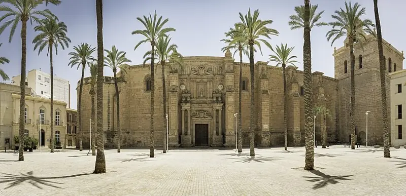
Almería Cathedral is easier to understand when you also read it as a fortress. Construction began in 1524 after the earthquake of 1522 destroyed the earlier cathedral. Solid walls, buttresses and corner towers served a double purpose: religious worship and protection for the population against attacks from the sea. Decoration concentrates around Renaissance portals, contrasting with the building’s defensive mass. Inside, periods overlap: a late Gothic structure, Renaissance work by Juan de Orea and later Neoclassical additions. On Calle Cubo, the Sun of Portocarrero has become an emblem of Almería. Walking around the outside reveals this combination before entering. Tourist visits use a specific entrance on Calle Velázquez, which is distinct from simply viewing the principal façade from the square.
Explanation source ↗3 / 8 · ALMERÍA
Separate outing beyond the central walk
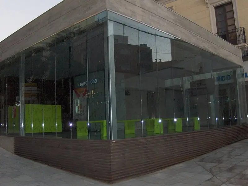
Beneath Almería’s streets, an emergency city was designed to protect lives during the Civil War. Guillermo Langle planned a network in 1936; building began in February 1937 and eventually produced around four and a half kilometres of tunnels. The section recovered for historical interpretation explains how shelter, supplies and treatment of the wounded could be organised, including a recreated operating room. After the war, some entrances became urban kiosks, concealing their original purpose. Distinguish the complete historic network from the museum section. Notice checked on 17 October 2026: the council announced a fresh works procurement on the thirteenth. Interior opening is not confirmed; whenever visits become available, they require advance admission arrangements rather than unrestricted entry from the street.
Explanation source ↗4 / 8 · ALMERÍA
Separate outing beyond the central walk
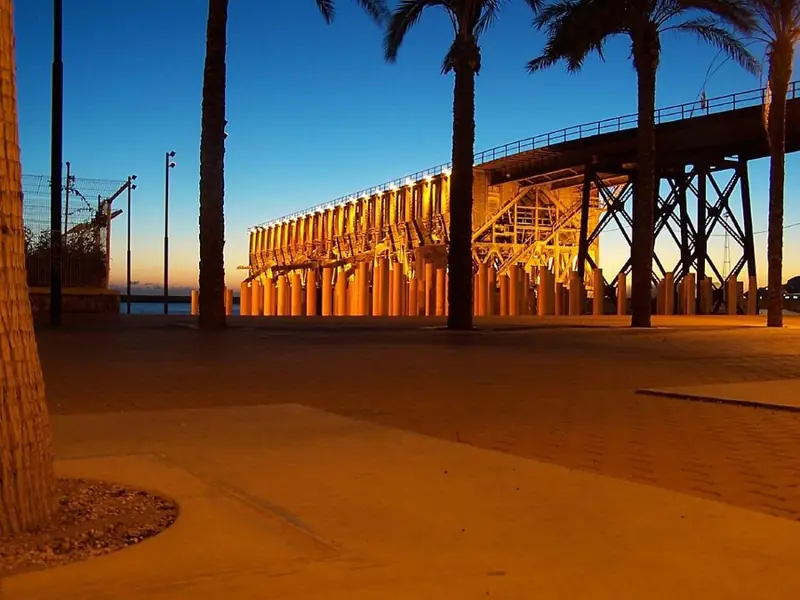
The Cable Inglés is an industrial machine transformed into heritage landscape. Built between 1902 and 1904, it loaded iron ore from Alquife onto ships in Almería’s port. Trains delivered the material, and the elevated structure enabled direct unloading into ships’ holds, reducing handling and costs. Notice the combination of masonry sections, large metal elements and the platform over the water: each part performed a specific task. Its popular name recalls the British company that owned it, rather than a communications cable. Restoration as a promenade offers views of city and sea from infrastructure once reserved for freight. The Port Authority identifies access through Parque de la Estación; check availability and opening arrangements instead of assuming you can enter from any point along the beach.
Explanation source ↗5 / 8 · ALMERÍA
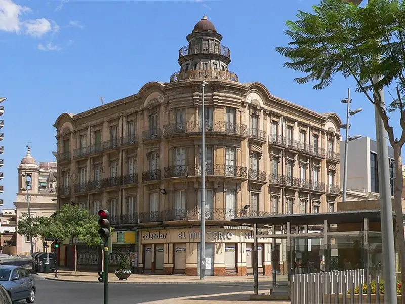
Puerta de Purchena preserves the name of an entrance that no longer exists. The Pechina gate once stood here, connecting the walled city with its surroundings. Demolition of the walls in 1855 made room for a different Almería, with new streets, businesses and prestigious housing. The square became a meeting point between the old town, the Paseo and expanding neighbourhoods. The province’s mining wealth helped encourage bourgeois architecture designed to display status. The House of Butterflies, designed by Trinidad Cuartara in 1909, is one reference point for that transformation. Look at the upper features of the façades and compare them with the idea of a defensive gateway: displaying prosperity eventually replaced controlling passage at this same location.
Explanation source ↗6 / 8 · ALMERÍA
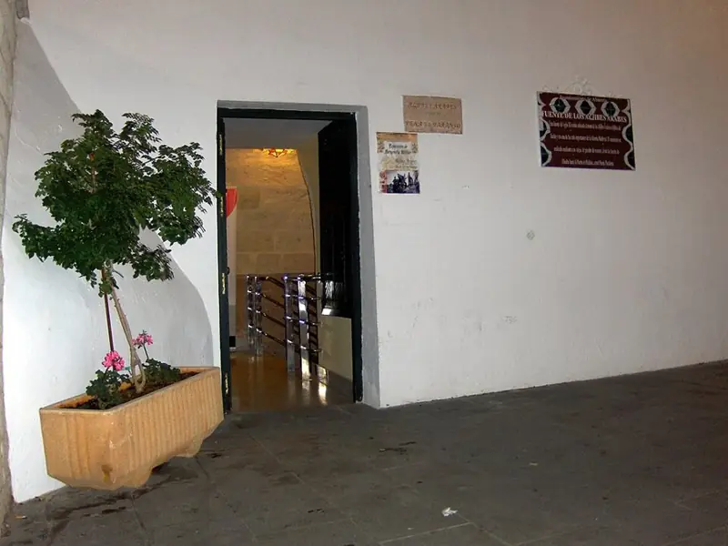
The cisterns remind us that storing water is another way of building a city. In eleventh-century taifa Almería, a channel from the Alhadra area supplied public tanks near the Pechina gate. Medieval sources disagree over whether Jayrán or his successor Zuhayr initiated the system, so its history should not be reduced to an unquestionable attribution. Three surviving interconnected chambers, covered by brick barrel vaults, reveal a system designed to maintain reserves. The traditional name Jayrán cisterns has remained alongside new cultural uses. Read the space as infrastructure before seeing an exhibition room: shape, material and location answered a basic urban need. It offers a useful counterpart to the nearby monuments that display political, military or religious power above ground.
Explanation source ↗7 / 8 · ALMERÍA
Separate outing beyond the central walk
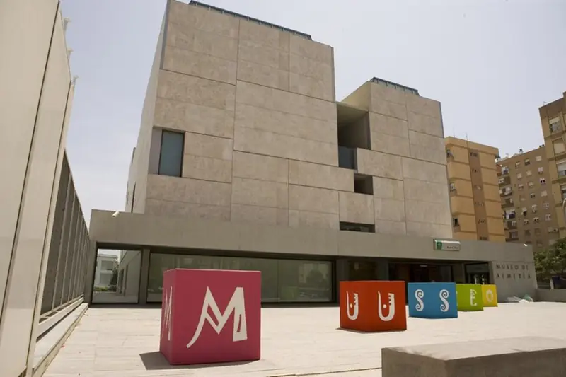
The Museum of Almería takes the story far beyond the Islamic city. Its displays emphasise Los Millares society in the third millennium BC and El Argar in the second. These are not merely names for two galleries: they refer to communities, technologies and forms of organisation studied through objects and their contexts. The institution was created in 1933, with a decisive contribution from Belgian mining engineer and archaeologist Luis Siret. The route introduces how research works, not just what has been discovered. Compare tools, burial goods and reconstructions to distinguish evidence from interpretation. Visiting this museum does not include access to archaeological sites elsewhere in the province: Los Millares needs a separate outing and its own transport arrangements.
Explanation source ↗8 / 8 · ALMERÍA
Separate outing beyond the central walk
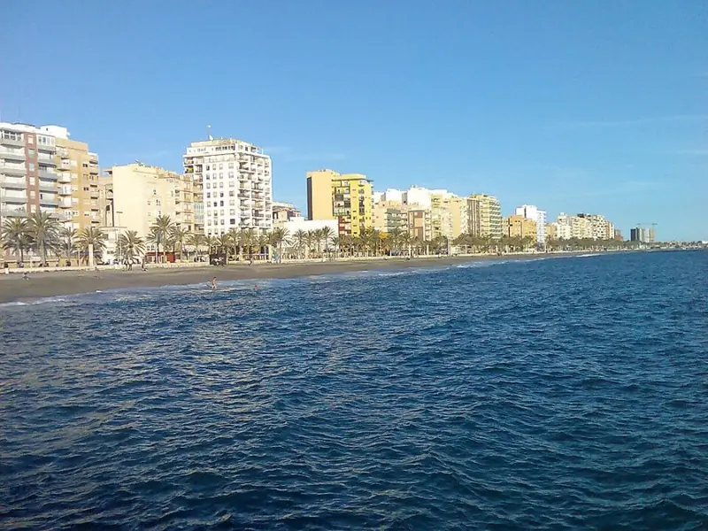
Zapillo shows a different Almería from the Alcazaba and the medina streets. This urban frontage opens towards the Mediterranean, with homes, shops and a promenade accompanying the beach. Tourist documentation also uses names such as San Miguel for this area, reminding visitors that everyday beach boundaries do not always match one label on a map. The interest lies in understanding the relationship between neighbourhood and coast: terraces, daily journeys, sport and relaxation share the same space. Compare this horizontal openness with the elevated defensive position of the Alcazaba. It is an extension to the central route rather than an obligatory stop between monuments. A section of promenade provides a fitting conclusion, facing the seascape that connected the city with other ports.
Explanation source ↗Calle Jovellanos, 7, 04003 Almería
Historic central tavern serving tapas and sharing dishes. Its website lists fried cod, marinated tuna and artichokes with anchovy; consult the current menu.
Official website ↗ · Walking directions ↗Calle Fructuoso Pérez, 12, 04001 Almería
Central fish and seafood restaurant. A seated meal near the historic route, with menu and booking information online.
Official website ↗ · Walking directions ↗Calle Real, 15, 04003 Almería
Old-town tavern offering tapas, sharing plates and traditional cooking. Its website confirms the address and provides a menu.
Official website ↗ · Walking directions ↗Editorial selection based on the venues’ own websites, not a personal dining review or sponsorship. Check opening, menus, allergens and prices before visiting.
Check final prices, conditions, tour language and availability on Civitatis. Optional paid activities; affiliate links may earn a commission.
See activities in Almería ↗Aena confirms urban bus 30 Almería–Airport–Retamar; consult the operator’s current route and timetable through Aena. Check current Renfe trains rather than assuming particular connections. Alcazaba access from Calle Almanzor involves an ascent; Cable Inglés access is through Parque de la Estación, not anywhere along the shore. Zapillo is an urban extension that may need a bus depending on your route. Cabo de Gata and Los Millares lie outside the central walk and need separate transport. Markers are approximate; accessibility has not been audited.
Emergencies: 112. For non-urgent medical assistance, consult local services.